FJD TRION™ V10i
GNSS SYSTEM
WITH VISUAL POSITIONING


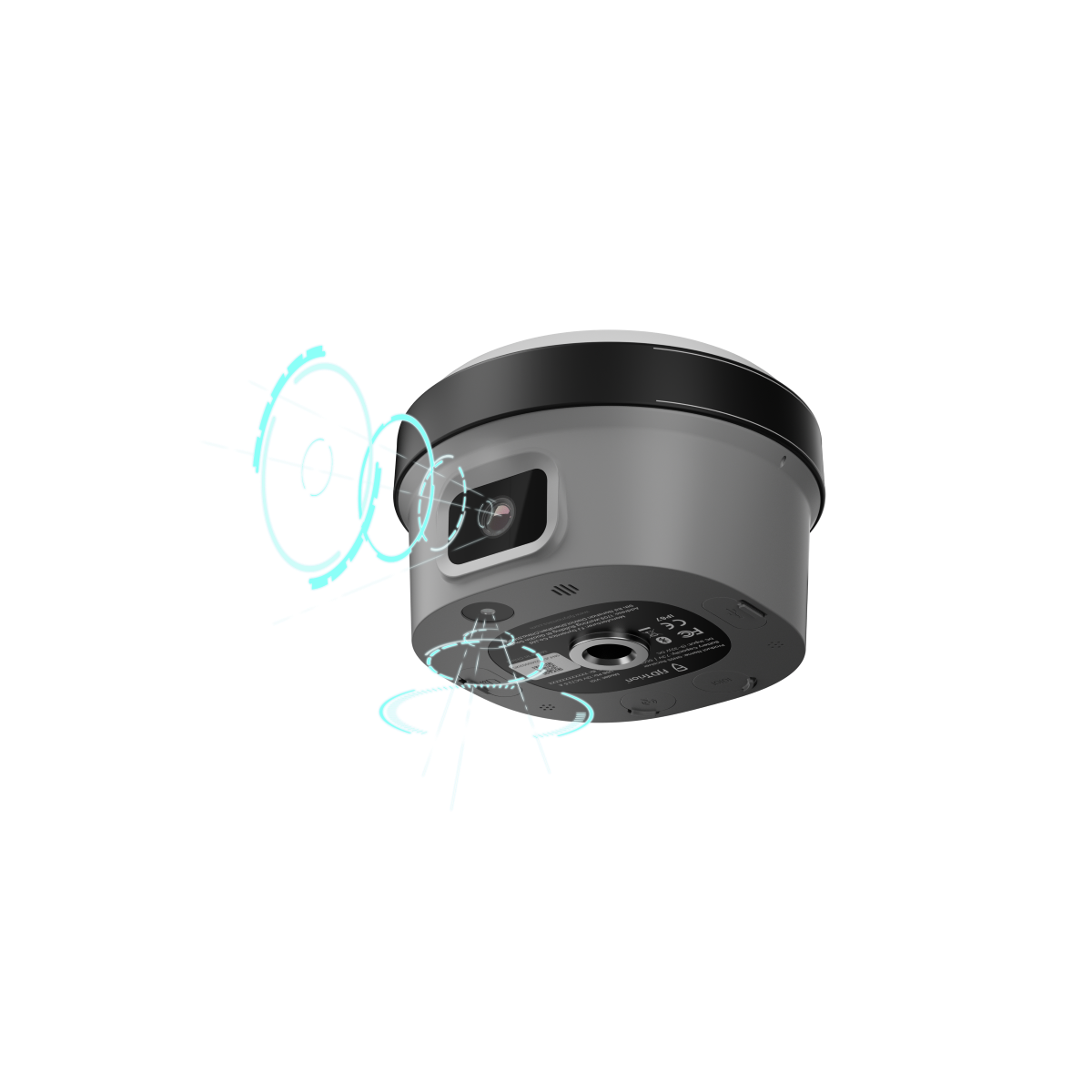
Twin high-resolution cameras,
Visual Measure and AR StakeOut

Max tilt 60°,
Calibration-free

H: 8 mm + 1 ppm RMS
V: 15 mm + 1 ppm RMS

IP68
2m Drop-proof

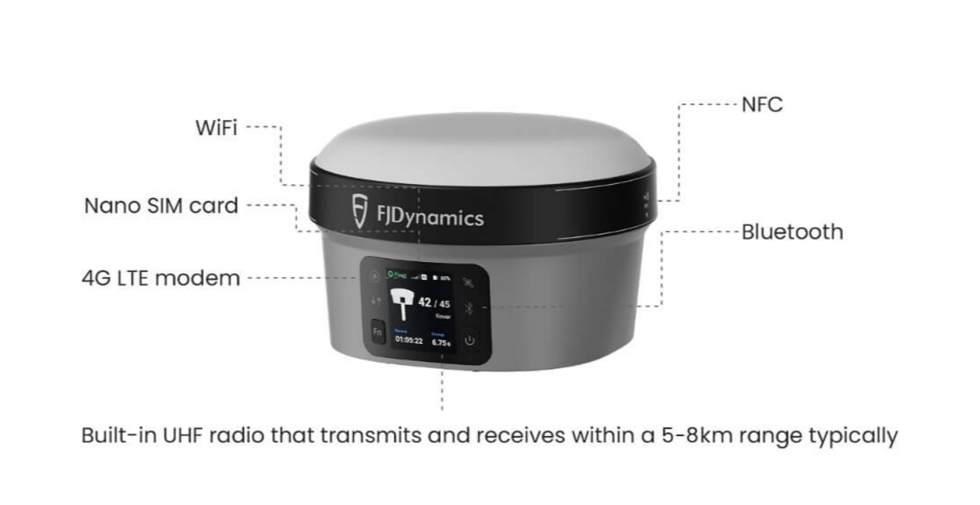
Built-in 4G LTE and UHF.
NFC, WiFi, Bluetooth

1408 chanels,
Full Constellations
Capture More, Worry Less
Get started with the V10i for efficient measuring tasks. Featuring an OLED screen, IMU, and dual cameras, the V10i enhances productivity to the next level. AR Stakeout provides real-time visual guidance during stakeouts, while Visual Measure facilitates measurements in challenging locations. The OLED screen introduces an interactive experience for surveyors.
Clear Vision, Precise Measurements
Equipped with a 2MP front camera and a 5MP bottom camera, the V10i delivers clear picture quality for surveyors. Its robust 4-core processor and multi-engine algorithm guarantee smooth imaging in the AR Stakeout feature. Additionally, in the image measurement function, obtaining centimeter-level precision coordinates is as simple as clicking on the photo.

Safer and More Efficient
Tilt Compensation
The V10i supports a Tilt Survey of up to 60 degrees, eliminating the need to hold the survey pole upright during measurements. This feature enhances measurement efficiency, especially in locations where it's difficult to keep the pole vertical. The Tilt Survey function effortlessly addresses these challenges.
AR Stakeout
The AR Stakeout feature revolutionizes traditional stakeout methods. With two high-definition cameras, it offers a clear real-time video view during stakeouts, directly displaying the point's location within the video. Real-time directional guidance facilitates swift identification of stakeout points.
Field to Office
Enhance Productivity with Trion Survey Cloud. 2 GB free storage with purchase of V10i.
Field and Office in Sync
Effortlessly link field and office teams together. Transmit field data and project updates instantly, accelerating workflow on both fronts. Say goodbye to waiting and hello to productivity.
Easy Project Management
Share system parameters and configure data settings,
such as coordinate systems, geoid models, and
datum grid files.
Built Tough, Engineered to Perform
The V10i's alloy body is lightweight and immune to magnetic interference. Its enhanced construction ensures reliable satellite connectivity, even in situations with obstructed sky or unfavorable weather conditions. You can rely on the V10i to continue functioning seamlessly, even if exposed to rain or accidental drops.
Stay Connected Wherever Your Job Takes You
You'll never need to fret about data transmission loss while in the field. Easily monitor the connection status on the spacious OLED screen, which boasts a brightness of 350 nits, ensuring clear visibility even in direct sunlight.

Application Scenarios

Cadastral Survey

Construction

Topographic Survey

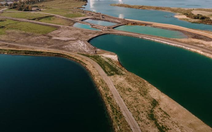
River & Coastline

Bridges & Roads

Utility infrastructure
Accessories
FJD Trion Field Controller E600
Slim and large screen ergonomic controller.
- 720*1440, 5.5-inch large screen
- 7700mAh, Fast Charge
- CPU 8 cores 2.0GHz
- Memory 3+32 GB
- 13 MP camera with auto-focus
- 1.5-meter drop-proof & IP67
- BT5.0 (BLE), NFC, WiFi, 2G,3G&4G


FJD Trion Field Tablet UA80
- Qualcomm QCM4290,8 cores 2.0GHz
- RAM: 6GB LPDDR; ROM: 128GB EMMC
- 8''Screen, HD 750nitst(type)
- Front 8MP, Rear 16MP
- BT5.0 @BLE
- 4G: TDD-LTE&FDD-LTE, 3G: WCDMA
- IP67, 1.2m drop-proof
- Lithium-ion (3.8V/8200mAH) removable, 10h
- Support Google GMS certification (optional)
High Power External Radio
- Support for mutiple protocols:
TRIMTALK, TRIMMARK III, TRANSEOT, and SATEL etc.
- Range: > 20km
- Multiple Channels, able to reprogram
- Input: 9~16V DC
- TX Power: 28W
- 2 kg, IP67

Download the technical specifications brochure for the FJD Trion V10i GNSS System With Visual Positioning
Download FJD Trion™ V10i BrochureCopyright © 2024 California Geospatial Solutions | Online Store
